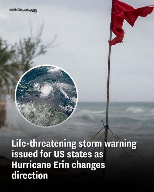
Hurricane Erin’s escalation from a tropical storm to a category five hurricane has sparked major warnings across seven states in the US, and surrounding countries as it changes path.
The storm was last noted to be moving northwest at 13 mph with maximum sustained winds of 100 mph, but further intensification hasn’t been ruled out.
Erin intensified to category five status on August 16 before being lowered to category three, but it is still expected to cause damage, according to NBC News.
The hurricane-force winds are expected to extend up to 90 miles from the center and tropical-storm-force winds to come up as far as 265 miles.
As the first Atlantic Ocean hurricane of hurricane season, Erin is looking to be a big one.
Which areas are set to impacted by Hurricane Erin?
Erin’s path has been heavily monitored by numerous mapping organizations and websites.
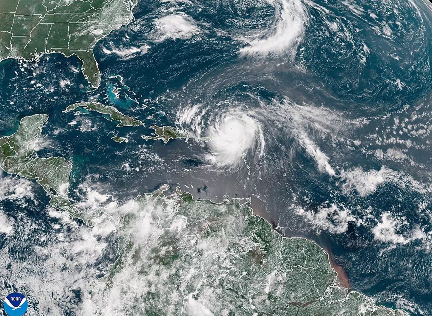
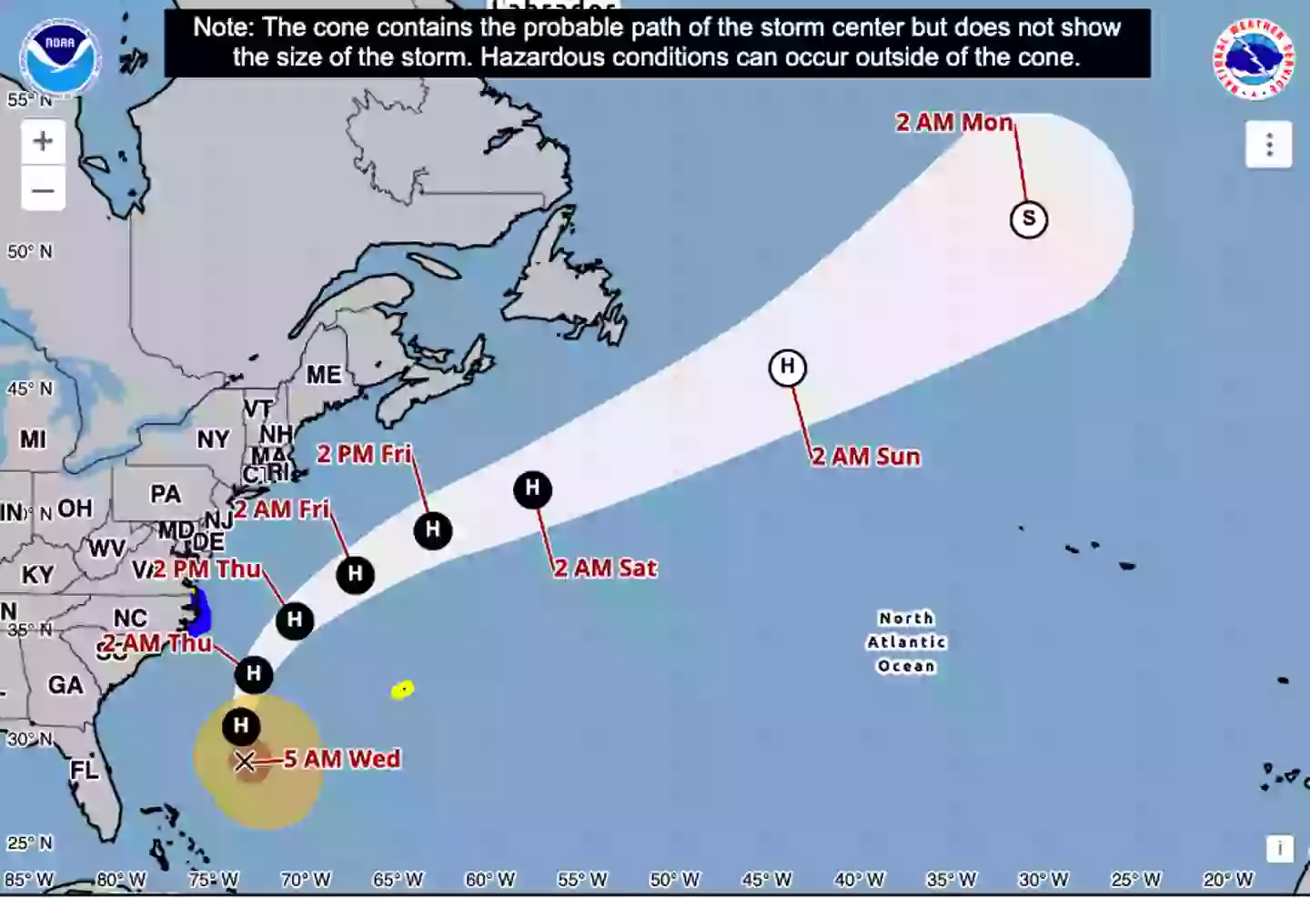
Its path is inching west compared with previous forecasts, and though it’s currently not expected to make landfall, this is still a possibility.
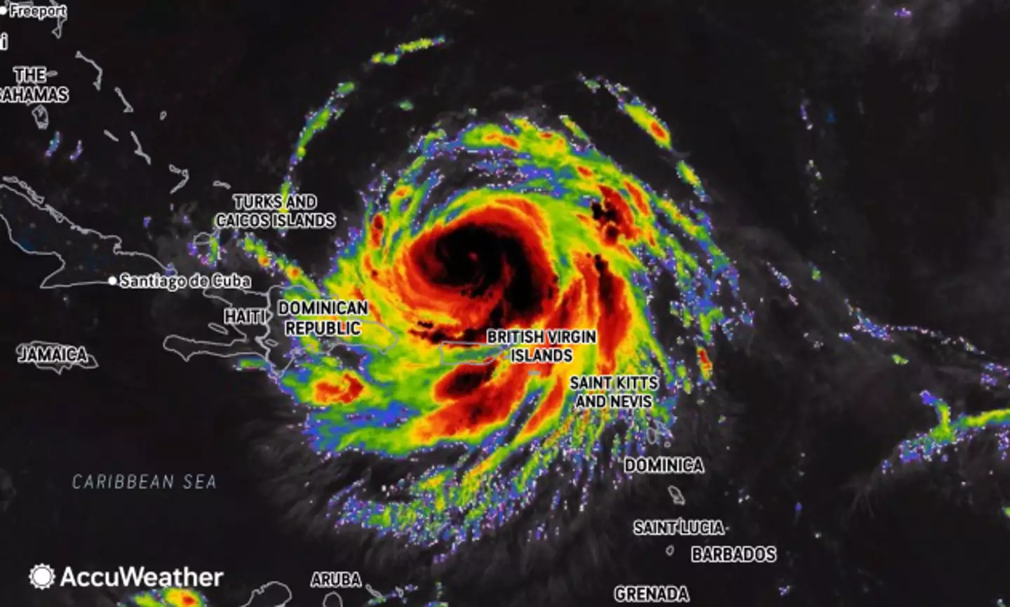
This morning (August 20), the NOAA warned the center of the hurricane is due to pass between the East coast and Bermuda from today through early Friday, then continue on past Canada.
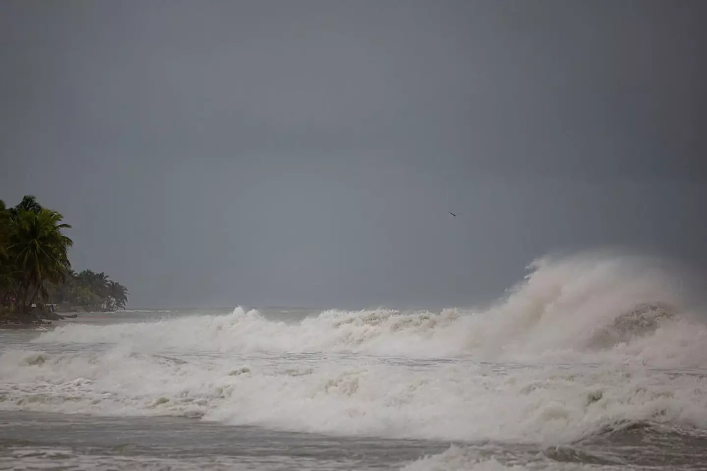
The organization tweeted to its followers: “NOAA is monitoring water levels and winds for Hurricane Erin, which is expected to produce life-threatening surf and rip currents along the beaches of the Bahamas, much of the east coast of the U.S., Bermuda, and Atlantic Canada during the next several days.
“These rough ocean conditions are expected to cause life-threatening surf and rip currents.”
The NHC said this morning that a storm surge warning was in effect for North Carolina’s Outer Banks from Cape Lookout to Duck, along with a tropical storm warning over the next 36 hours for Beaufort Inlet, North Carolina to the North Carolina/Virginia border, including Pamlico and Albemarle sounds.
Just this weekend on Sunday (August 17), Erin’s outer edges hit parts of Puerto Rico and the Virgin Islands with heavy rains and winds, knocking out power for thousands of people.
Government officials in the Turks and Caicos Islands also confirmed all services were suspended on three of its islands as it ordered all residents to stay home.
What have experts said about Hurricane Erin?
Hurricane Erin is expected to cause chaos for many of the areas effected, particularly Bermuda.
While the island won’t feel the full intensity of the storm until August 21 (tomorrow) evening, acting Minister of National Security Jache Adams said, storm surge would make waters too dangerous to swim, surf or boat on.
Because Erin is expected to remain a large force until mid-week, the hurricane center’s Richard Pasch told PBS: “You’re dealing with a major hurricane. The intensity is fluctuating. It’s a dangerous hurricane in any event.”
The NHC’s alert shared that water levels could rise two to four feet above ground along the North Carolina coast (Cape Lookout to Duck).
“The combination of a dangerous storm surge and the tide will cause normally dry areas near the coast to be flooded by rising waters moving inland from the shoreline,” the agency said. “The water could reach the following heights above ground somewhere in the indicated areas if the peak surge occurs at the time of high tide.”
Which warnings are in place for Hurricane Erin?
The National Hurricane Center and Central Pacific Hurricane Center stated that it will be far too dangerous for beach-goers to swim in the ‘next few days due to life-threatening rip currents’ in the wake of Erin’s new course of direction.
Because of the potential dangers, North Carolina officials declared a state of emergency and ordered mandatory evacuations for Ocracoke and Hatteras islands.
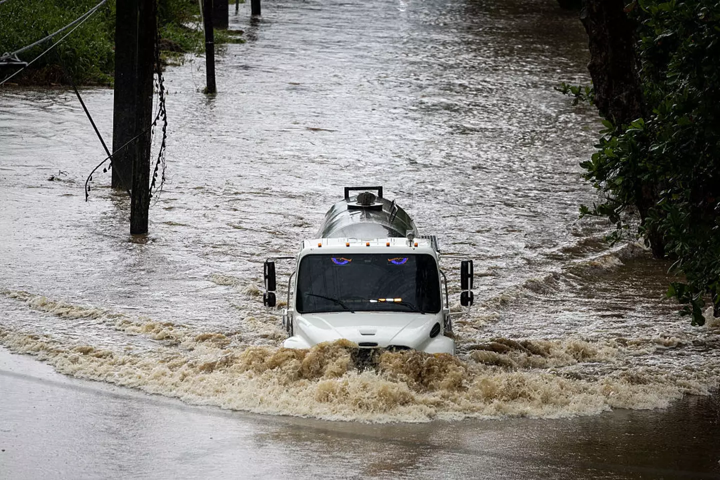
Even though Erin isn’t thought to be able to hit land at this rate, it very well could produce 20-foot waves and dangerous rip currents along the East Coast.
The storm and high waves could also lead to beach erosion, overwash and blocked roads.
The latest updates note that Erin is still growing in size, meaning that the tropical-storm winds are extending closer to the Mid-Atlantic and southern New England coasts at the tail end of this week.
Frightening reason Hurricane Erin is so intense as urgent warnings issued to these parts of the US
Hurricane Erin is expected to cause chaos on the US coast
Hurricane Erin has produced dangerous warnings to those living nearby, and there’s a good reason why.
Hurricane season is here, typically running from June 1 to November 30, but one that seems to be a little too close to the US is Hurricane Erin.
The hurricane has kept forecasters on their toes after initially being reported as a Category 1 hurricane, and then turning into a Category 5 hurricane within 24 hours, CNN reports.
Warnings have been issued in certain areas, urging people to steer clear of the coast.
The National Hurricane Center (NHC) said on Saturday (August 16): “Erin is expected to produce life-threatening surf and rip currents along the beaches of the Bahamas, much of the east coast of the US, and Atlantic Canada next week.”
But why are the warnings so sure it’ll cause so much damage?
Hurricane Erin’s escalation
Hurricane Erin is one of the 43 Category 5 hurricanes on record in the Atlantic.
Per the National Weather Service, Category 5 hurricanes are storms that reach wind speeds of 130 to 150mph, which then have the ability to cause ‘catastrophic damage’.
“Well-built framed homes can sustain severe damage with loss of most of the roof structure and/or some exterior walls,” it warns.
“Most trees will be snapped or uprooted and power poles downed. Fallen trees and power poles will isolate residential areas. Power outages will last weeks to possibly months. Most of the area will be uninhabitable for weeks or months.”
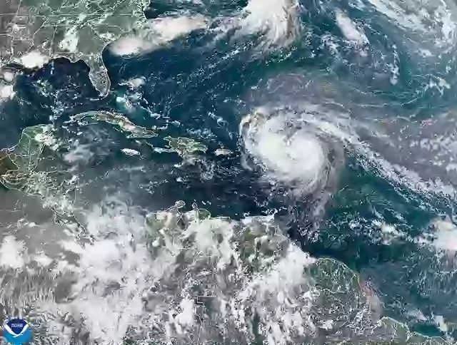
Erin began as a tropical storm west of Cabo Verde, before traveling over the Atlantic and turning into a hurricane on Friday (August 15). It appeared to get stronger from then on – a process known as rapid intensification.

While it was a Category 5 on Saturday in the Caribbean, it was lowered to a Category 4 shortly after weakening, the NHC said.
It’s not expected to hit continental United States, but its strong winds can cause landslides and other damage.
Some meteorological services for the Turks and Caicos Islands issued a Tropical Storm Watch for the British Islands to its southeast.
Although Hurricane Erin downgraded to a Category 3 in the early hours of Sunday morning (August 17), it is predicted to go back to Category 5 before it make its way around the US coast.
What is rapid intensification?
Erin underwent rapid intensification, which occurs when a storm has wind speeds of more than 58 miles per hour in a 24-hour window.
As per CBS News weather producer David Parkinson, its tight core and low wind shear makes it the ‘perfect conditions for rapid intensification’ when traveling over water, that’s warmer than usual.
Hurricane season typically peaks in mid-September, which makes Erin’s intensification and strength unusual for this time of the year.
With so much power and unpredictability, it can also make it harder for the government to plan ahead.
Rapid intensification can see coasts flooding, heavy rain and more.
For Erin, it is expected to produce heavy rain across the northern Leeward Islands, the Virgin Islands and Puerto Rico, with local flash and urban flooding, and landslides or mudslides, expected to happen, according to the National Hurricane Center in Miami.
Hurricane Milton was the last known Category 5 storm which also underwent rapid intensification, turning into a Category 3 on impact with Florida, killing a dozen people.
Hurricane Erin is expected to pass the northern Leewards, the Virgin Islands and Puerto Rico, the NHC said, before remaining offshore of the US East Coast.

Urgent warning to these areas as hurricane moving towards US has potential for ‘catastrophic damage’
Hurricane season is well and truly here.
The Atlantic hurricane season runs from June 1 all the way to November 30 and the latest storm headed towards the US is Hurricane Erin.
The hurricane has been intense from the very beginning and was initially reported to be a Category 1 hurricane after hitting wind speeds of 75mph. Within 24 hours, this had hiked a rare Category 5 hurricane, CNN reports, making it one of only 43 Category 5 hurricanes on record in the Atlantic.
Per the National Weather Service, Category 5 hurricanes are storms that reach wind speeds of 130 to 150mph which can cause ‘catastrophic damage’.
“Well-built framed homes can sustain severe damage with loss of most of the roof structure and/or some exterior walls,” it goes on to warn.
“Most trees will be snapped or uprooted and power poles downed. Fallen trees and power poles will isolate residential areas. Power outages will last weeks to possibly months. Most of the area will be uninhabitable for weeks or months.”
In light of the intensity of the storm, the National Hurricane Center was forced to issue an urgent warning on Saturday (August 16).
One of its key messages stated: “Erin is expected to produce life-threatening surf and rip currents along the beaches of the Bahamas, much of the east coast of the US, and Atlantic Canada next week.”
AccuWeather Lead Hurricane Expert Alex DaSilva has shared more details on what to expect.
“Erin is forecast to slowly curve to the north as it continues to strengthen over the weekend. At this time, the storm is forecast to remain hundreds of miles off the East Coast,” DaSilva said.
“Beaches along the entire East Coast, from Florida to New England and Atlantic Canada, will likely experience rough surf and dangerous rip currents as Erin tracks north and eventually northeast,” the weather expert added.